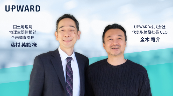
With the SDGs and the idea of sustainability as the cornerstone of strategy becoming the standard for business, how can we fit our solutions while advancing our business? UPWARD, a provider of app connect data to platforms through location information, held a dialogue with the Geospatial Information Authority of Japan (GSI) on March 3, 2021, under the theme of "Solving Social Issues Achieved through Geospatial Information". What is the idea of co-creation value created by a location-based SaaS and a national mapping agency with a history of over 150 years? The interview is packed with messages that we would like to convey to all those who are aiming to fit their businesses into the "Society 5.0" era. Please take a look. Part 1: [GSI x Location-based SaaS: Special Dialogue Part 1] Co-creating value to solve social issues through geospatial information
GSI Special Dialogue [Part 2] Co-creating Value to Solve Social Issues with Geospatial Information
Recommended Documents
-
SUCCESS STORIES OF COMPANIES THAT HAVE ACHIEVED RESULTS WITH UPWARD
Click here to download the document
Pickup Articles
Table of Contents
GSI's vision for improving Japan's resilience to be fulfilled by GSI's Geographical Survey Institute Map x UPWARD.

The GSI has a history of more than 150 years of map production, but one of the challenges it faces today is how to ensure the " connection between the people who make maps and those who use them. GSI produces and publishesaccurate maps on a daily basis, but it is not always possible to follow up on " how exactly people use the maps" in its daily operations.
GSI does not have information such as what kind of stores are located in a town. However, it does have information on where there are slopes and disaster risks. As a provider of such basic geospatial information, we would like to steadily provide maps " to those who need them, when they need them," but we are struggling with how to achieve this. Although we have established the " GSI Map Partner Network," a forum for information exchange between contract developers, tool providers, and the G SI, we are still struggling with a lack of ways to bridge the gap between what the GSI wants to communicate andwhat users want to use.

(The GSI is experimenting with providing "GSI maps," which can represent various data held by the GSI in layered form.)

The following items have been formulated as the mission of the Ministry of Land, Infrastructure, Transport and Tourism in the SDG Action Plan 2021.
[Promoting partnerships through geospatial information]
Promote the use of geospatial information in multiple fields, including disaster management, through domestic and international partnerships, including the UN Initiative, the UN Committee of Experts, collaboration with local governments, and industry-academia-government partnerships.
In order to achieve the SDGs, it is effective to think of international cooperation anddomestic implementation as one, but I think it works well to think of these common goals from the perspective of " thinking of a simple message that can be conveyed to people overseas. I believe that thinking from the angle of "the United States is the best way to achieve SDGs" will work.
In the U.S., many government agencies involved in geospatial information seem to be able to utilize it within the budget framework of "saving lives. We are also thinking about how we can strengthen our support through geospatial information to those who are conducting operations in Japan, such as firefighters,police, and front-line field personnel of local governments.


I think that the GSI has no choice but to utilize the digital data of GSI maps in order for the GSI to be an information infrastructuretoprotect the lives of the people. I think it would be a great step forward if they promote a framework where the UI/UX part is left to private companies like us, and they provide information in an easy-to-use form in the cloud as a content provider.
I think it is important to be able touseGoogle Maps for everyday use and switch to Geospatial Information Authority (GSI) map data in case of emergency. In this day and age, information on disasters andaccidents is often faster on social networking services than in the general media. The approach of connecting through the Internet and appcommunications is essential.
(During the Kumamoto earthquake in 2016, the mayor of Kumamoto City used Twitter to provide information to citizens on a daily basis. The content was wide-ranging, including information on the damage, evacuation shelters, and calls for volunteers, and it helped ensure the safety of citizens under unstable conditions.)
Of course there is a BCP app for such contingencies, but there is no such thing as suddenly being able to use something that is not used on a daily basis in an emergency. In fact, there have been cases where laptops have been sent to affected areas as supplies, only to find that they have become dead stock, taking up space because the infrastructure is inadequate or there is no time to start up the computer in the first place.

According to an ESCAP (United Nations Economic and Social Commission for Asia and the Pacific) report*, 54% of annual disaster damage occurs in Asia and the Pacific, and Japancomes out as the country with the highest amount of damage for various types of disasters. Like it or not, a significant proportion of the world's disaster damage occurs in Japan. I am aware that local government officials are working extremely hard on the front lines of these disasters in Japan. We would like to improve how we can support their activities with GSI'sgeospatial information.
(*) Asia-Pacific Disaster Report 2019
https://www.unescap.org/publications/asia-pacific-disaster-report-2019
And one approach to do that is to use the GSI's map I would like to consider having people use vector tiles.

Yes, we do. The people who are working for reconstruction in the disaster-affected areas are almost the same as the field sales people from private companies that we usually support in the field, in terms of " leaving behind logactivities. The only difference is that there is a public nature andurgency to it. I think there is a lot of value in just being able to easily use the disaster-related map information maintained by the government for disaster recovery activities.
Of course, it is not limited to emergencies, but we would like to support the " daily operations" of " people who provide services to local residents," such as themanagement of vacant houses in the community and the daily maintenance of public facilities.
I think it is really important forlocal governments and people in the field, who have difficulty making large IT investments, to use inexpensive, up-to-date IT services in their activities for local residents.

(UPWARD aims to create a solution for local governments that allows them to use appfor part of their daily operations and to expand the number of licenses freely in case of emergency, in a " pay-as-you-go,pay-as-you-go " model similar to a utility bill.)

This may sound rude, but I think there are many people in Japanwho have no idea what the GSI does. I am sure there are some in companies like ours that deal withmaps andlocation-based technology. But they spend a lot of money every year updating their map infrastructure and conducting field surveys on a daily basis.
SaaS providers like us can use the " national assets" produced by the G SI to support reconstruction in times of disaster and to provide services to local residents on a daily basis. I believe that by continuing to say, " This is using GSI's data," and steadily making examples of this, the co-creation value that cannot be created by the culture of delivery will spread more and more.

Yes, it is. Multi-sector collaboration is very important, but I think it is a world that we do not really realize as we gain experience only within the Japanese government. For example, there is a culture within the GSI that says, "We want to complete everything from map creation to appcation by ourselves. However, this does not allow GSI, nor any other player, to provide the necessary services when customers need them as an ongoing business.

I would like to see vector tile maps fly to various IT infrastructures and be used in different places. If we can create a case study that supports people working in local governments while utilizing the GSI map dataas a component, it will be a case study that can be introduced to the world as a case study in Japan. If we can present it as a case study, we can further share wisdom globally and make it into a universal design, which can be improved and scaled. I feel that it would be very good if we could turn such a loop.
Also, I think it could be extended to educational institutions. Education is also about fostering the next generation. I would be happy if we could increase the number of talented students who are interested in the surveying industry and the GSI within it (laughs).
Conclusion - Future Initiatives and the Importance of "Naturally Clean

Why is it that Japan, with so many people involved in IT, lags behind in these areas of innovation?
Even if you have a lot of good and well-crafted information, it's hard to come up with platforming ideas that " everyone can use ".


Perhaps Japanese culture is highly artisanal. I think the platform is a " partition, " and as the oligopoly of that partition progresses, the world will become a place where " craftsmanship " is emphasized within the partition. I think that Japanese culture excels in the area of creating and inserting components (building blocks ) into the " dividers.
I have also heard people say that Japanese people are good at being secretaries, or at looking around. They tend to communicate carefully, have good coordination skills, and are naturally able to think outside the box. I think that is why they have the ability to create the necessary components within an established platform.

I would like to connect with overseas companiesthrough partnerships, while taking advantage of fields in which Japanese people excel.
However, especially in this era ofcloud computing andglobalization of the market, I believe that we need to connect what used to be divided vertically.
If a national character is not good atthinking across the board from a global perspective, we should first try to connect domesticcompanies in the same industry. I believe that we need to do more and more things that increase co-creation value by 2 to 5 times byforming partnerships in industry, academia, and government.


(In the case of support for the areas affected by the July 2020 torrential rains, which was carried out by combining Salesforce, UPWARD, and box, the speed of issuing disaster victim certificates was greatly improved, and has become a reference for many municipalities as a good practice.)

There is a conference of experts called UN-GGIM* that is held annually in New York and Bangkok.
*"United Nations Committee of Experts on Global Geospatial Information Management"
This expert conference is a conference body in which private companies can participate and This is a forum for the exchange of information among experts who are actually using geospatial information in practice, transcending sectors. As a " community of practice," it is a forum for the exchange of better information with " trust " as its currency.
It would be wonderful if more companies with knowledge of Japan, such as UPWARD, could participate in such expert meetings and connect with each other as geospatial information experts working in a global context. For example, it would be great if we could present the GSI's map data x UPWARDframework, and present a solution that is built in a Japanese way, and get feedback.

(*Link to external site)

Thank you very much. I hope we can have a mid- to long-term discussion based on the SDGs on how we can work on partnerships in the future, using the GSI as a trigger.

Yes, I agree.
In this connection, people overseas often advocate "cleanliness" first and then polish it up.

Microsoft and Salesforce both say beautiful things, but there is substance in them. So by continuing to say it, the worldview is locked in, and the people around you become enthusiastic.

For Japanese people, it may feel like " that's just a commonplace beautiful thing," but it is precisely because it is a " commonplace beautiful thing " that it is a strong concept that no one can deny, in other words, that everyone can agree on.
The person who cancarefullyput into words what is obvious and say, " Make this a priority! The person who can say, "This is a priority," takes the leadership.
Today, it was very nice to talk with a Japanese company who can say beautiful things.

Thank you very much. Please continue to work with us.

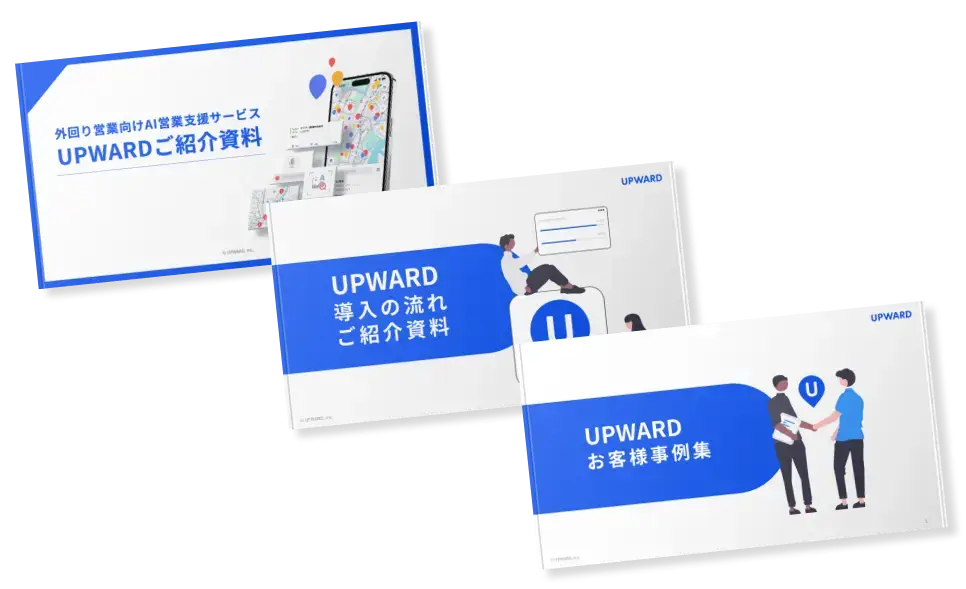
A full overview of the benefits and best practices of the introduction of the system
Download a free set of 3 documents